TypeArable · Pasture Land
HP1 Upper Bourne End Lane, Hemel Hempstead
TenureFor rent
Specification
- Land size
- Land size10.30acres
- Property type
- Property typeArable · Pasture Land
- Tenure
- TenureFor rent
Description
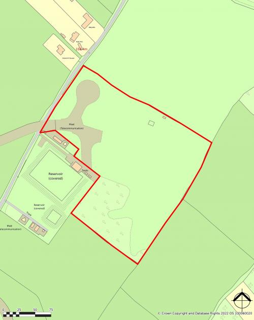
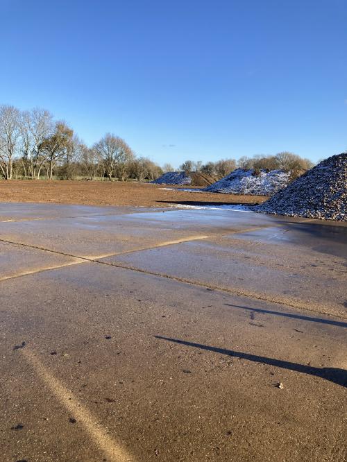
Fenced and enclosed land situated in the Green Belt which originally formed part of Bovingdon Airfield which was built in the Second World War and used until 1968. The land is made up of a concrete section located in the north east corner which adjoins Upper Bourne End Land which provides road access. The land is suitable for Green Belt compliant uses and a substantial part of neighbouring land which was also originally part of the air field now comprises film sets. Any use is subject to prior statutory approval as appropriate.
Location
Located on the southern side of the A41 with access via Bourne End Land (follow "Driving Academy " signs) Approximately 8km/5 miles north west of M25 Junction 20.
Amenities
1 Acre/0.40 Hectares Concrete
9.30 Acres/3.70 Hectares Grass/Open Land
Road Access
Fenced
Formally Part of Bovingdon Airfield
Neighbouring Land Used As Film Sets