TypeGeneral Industrial units · Warehouse · Open Storage · Industrial Development Land · Development - Residential
GL11 former Sundeala Site, Middle Mill, Cam, Dursley
TenureFor sale or rent
Specification
- Building size
- Building size7,144 - 71,444sqft
- Property type
- Property typeGeneral Industrial units · Warehouse · Open Storage · Industrial Development Land · Development - Residential
- Tenure
- TenureFor sale or rent
Description
Opportunity for industrial owner / occupier relocation or for mixed use re-development
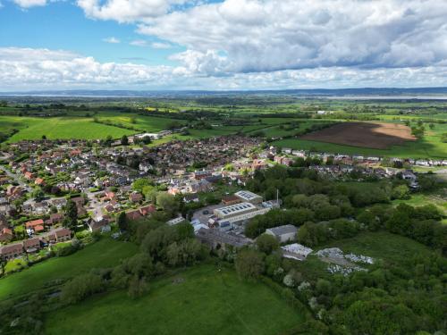
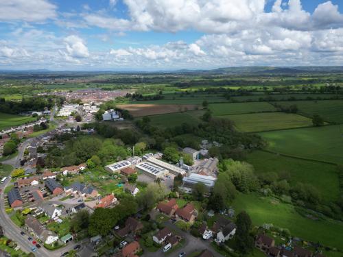
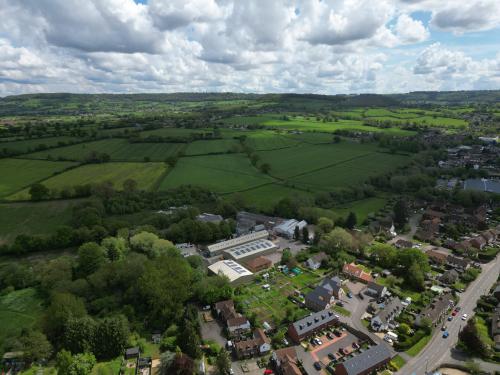
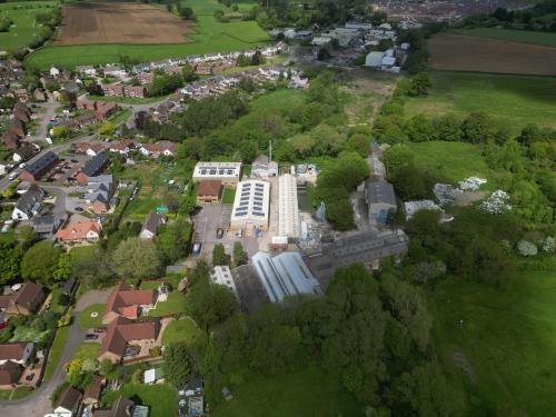
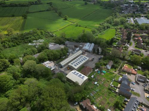
The site extends to approximately 10.12 acres (4.09 hectares) of brownfield land situated 100 metres east of Cam High Street and approximately 1 mile north of Dursley town centre. Access to the site is from the High Street via a private access road. The site comprises a range of industrial buildings, a two storey office block, car park, yard areas and two 3 bedroom semi-detached residential dwellings (nooos 68 and 70 High Street) with allotments to the west and land used for storage to the east. More details on the existing accommodation are available on request.
Until recently, the industrial buildings and office block were used in conjunction with the manufacture of pin board and ancillary uses. The vendor has recently ceased operations, however the buildings and equipment remain in situ pending the conclusion of this marketing process. The topography of the site varies but in general slopes from south to north in line with the River Cam, which runs through the centre of the site.
The main body of the site, including the allotment gardens, is currently allocated as a Key Employment Site within the Stroud District Local Plan, adopted in November 2015. The open storage / expansion land, forming the eastern portion of the subject site is allocated under Policy SA3. This policy area covers a wider area on the north eastern fringe of Cam, designated for mixed use development including employment, residential and community uses.
This marketing process represents an opportunity for a redevelopment of the site for alternative uses on part or as a whole. In so far as the principle of development is concerned, there appears to be strong grounds to support development on the eastern part of the site, subject to the trees, vegetation and any related biodiversity interests not proving to be an impediment to development. The part of the site to the west of the River Cam falls within the settlement boundary and since it is previously developed there is some positive support for the principle of redevelopment. This area is however protected for employment purposes and it would be necessary to demonstrate alongside any planning application that this policy restriction is outweighed by material considerations, such as a lack of market demand.
In the event that the site is re-developed for residential purposes there will be no CIL payable, as in accordance with the Stroud District Council CIL Charging Schedule "because of issues of viability, residential proposals on land within the Stroud Valleys charging zone are exempt".
Location
The site is located in Cam, a large village and civil parish in Gloucestershire, situated on the edge of the Cotswolds and contiguous to the town of Dursley, approximately 13 miles south of Gloucester and 23 miles north of Bristol. Cam has a range of local amenities including two supermarkets, three primary schools and a community hospital.
Main transport links are via Bristol Road (A38) and the M5, with the A38 approximately 1.4 miles to the north and J13 of the M5 lying approximately 5.3 miles to the north. The nearest railway station is Cam and Dursley, approximately 1 mile to the north, which provides national mainline rail links on the Bristol to Birmingham route.
Amenities
10.12 AcresLocal Plan for mixed use redevelopment
Freehold Vacant Possession