TypePasture Land · Woodland · Land for Excavation
RH9 133.63 Acres, North Park Farm, North Park Lane, Godstone
TenureFor sale
Specification
- Land size
- Land size133.63acres
- Property type
- Property typePasture Land · Woodland · Land for Excavation
- Tenure
- TenureFor sale
Description
Lot 2: Land at North Park Farm
Godstone, Surrey
Approximately 133.63 acres (54.08 hectares)
THIS HOLDING PROVIDES AN OPPORTUNITY
TO PURCHASE LAND WITH DEVELOPMENT
POTENTIAL AND A STRONG RENTAL INCOME.
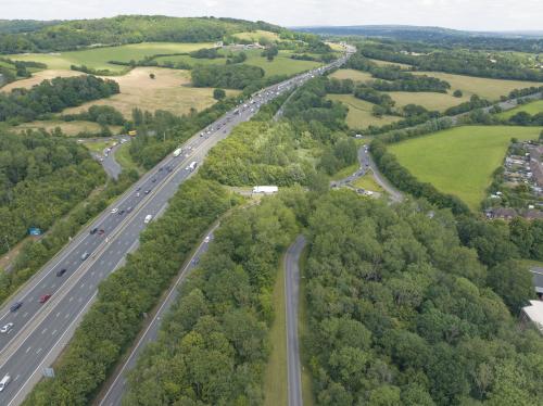
The majority of the land is south of the M25 with easy
access to Junction 6. The land adjacent to Godstone has
development potential (subject to Planning Permission).
The holding benefits from income from an existing
quarry haul road and other land that may be suitable for
Biodiversity Net Gain opportunities.
Oxted 3 miles | Gatwick 8 miles | London 17 miles
(via train from Oxted Station to London Victoria 30 mins)
(All distances and times are approximate).
LOT 2: LAND AT NORTH PARK FARM, GODSTONE
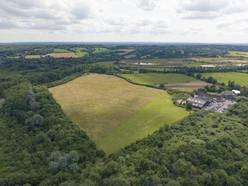
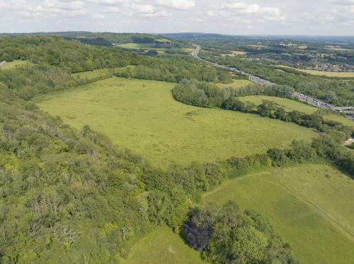
The Farm extends to a total of approximately 133.63 acres of pastureland and woodland. The farm is let on 3 different
tenancies and includes a mineral quarry haul road, let on a commercial lease to an adjoining quarry operator on a revenue style
rent. The land also benefits from potential development opportunities (subject to Planning Permission). A plan
detailing the areas included within each tenancy is available within the data room.
The Land in more detail comprises:
LAND AT NORTH PARK FARM, GODSTONE (QUARRY HAUL ROAD) (Blue on the plan)
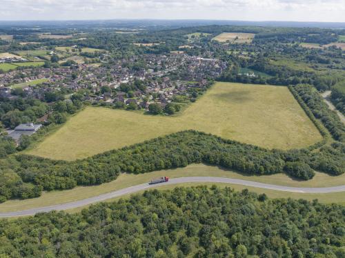
The land extends to approximately 28 acres and forms the landscaped access road to the adjacent quarry from the adjacent
M25 Junction 6 roundabout. The income is based on a royalty payment, which is indexed annually to RPI with 5-yearly
market rent reviews.
Further details of the lease are available in the data room.
LAND ADJACENT TO TYLERS CLOSE (EAST OF HAUL ROAD)
(Yellow on the plan)
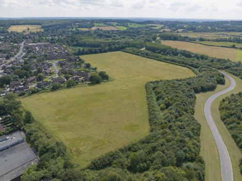
The land extends to approximately 21.87 acres of pastureland. In the recently
withdrawn Tandridge Local Plan, the land was a 'preferred allocation' for residential
development.
The seller has commissioned a Pre-Planning Application for potential residential
development and the Council's response is awaited. The Pre-App request and recent
Planning representations are in the data room. There are claims of rights of way around
the perimeter of this land which are being rebutted by the Seller. Further details are
in the data room.
LAND TO THE WEST OF HAUL ROAD (Pink on the plan)
The land extends to approximately 22.16 acres of pastureland with long-term
development potential (subject to Planning Permission).
INHAND LAND (Green on the plan)
This extends to 13.10 acres of land and woodland located between the haul road and
the M25, a small area of woodland north of the M25 and other parcels of land at either
end of the haul road. These areas benefit from Vacant Possession.
LAND TO NORTH OF M25 (Orange on the plan)
The land extends to approximately 29.23 acres of pastureland and may have potential
for carbon sequestration or Biodiversity Net Gain opportunities (subject to surveys).
OVERAGE
North Park Farm, Godstone is subject to an 80-year overage which commenced on 27th
May 1998. The beneficiaries are to be paid 50% of the Net Development Value triggered
on the grant of Planning Permission. This document was varied in part on 13th July
2005 to reflect the haul road lease income. Further details are in the data room.
Location
Located adjacent to the popular settlement of Godstone, close to the North Downs and nearby towns Caterham and Oxted. Godstone benefits from a wide range of amenities including several shops, boutiques, cafes, gastro pubs and a village green. The area has excellent transport links with some direct train services to London from Caterham and Oxted train stations. Junction 6 of the M25 (adjacent to the land) provides easy access to the national highway network.