TypeDevelopment - Residential
TS15 2.95 Acres, Garbutts Lane, Hutton Rudby
TenureFor sale
Specification
- Land size
- Land size2.95acres
- Property type
- Property typeDevelopment - Residential
- Tenure
- TenureFor sale
Description
Residential Development Land at Hutton Rudby
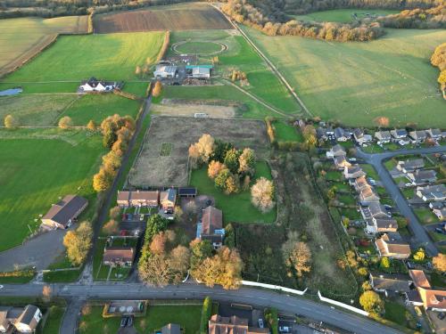
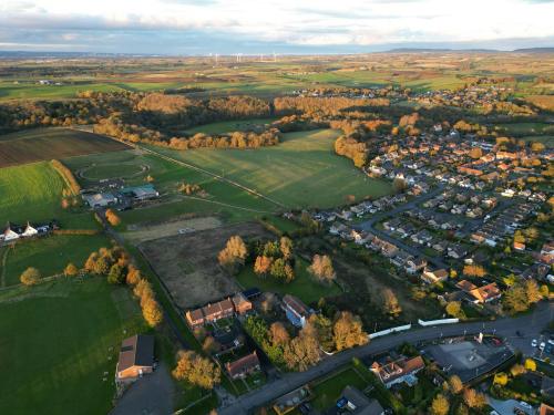
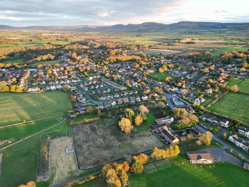
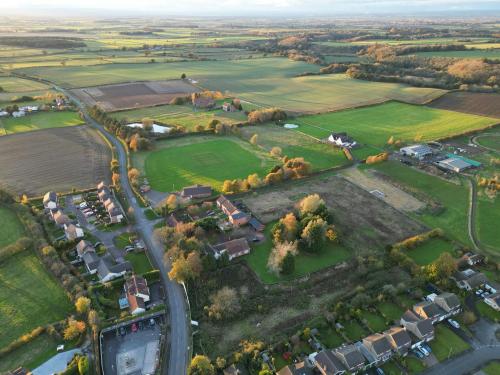
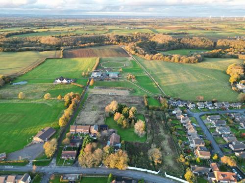
The site comprises 2.95 acres (1.19 ha) of green space with no. 66 trees, the majority of which are located at the southernmost parcel of the land near Garbutts Lane. The land is slightly sloped from west to east with a maximum of 1m difference between the highest and lowest points according to topographical mapping. The land is labelled on LandIS as soilscape 18 'slowly permeable seasonally wet slightly acid but base-rich loamy and clayey soil'. Hundale Gill Beck passes through the site, adjacent to the boundary of Hutton Fields. The beck is lined with dense scrub, which is also found within the corners and boundaries of the site. Within the site, the scrub and grassland are a slightly more managed, albeit still overgrown. There is an existing field access into the site off Garbutts Lane.
Location
The land is situated on the eastern edge of the village and civil parish of Hutton Rudby and is accessed off Garbutts Lane. Just 4 miles (6.44 km) east lies the Market Town of Stokesley on the Western edge of the North York Moors National Park.
The property is located 12 miles (20 km) south of Middlesbrough, 17 miles (27 km) east of Darlington, 34. miles (55 km) west of Whitby, 17 miles (27. km) north of Thirsk and 39.7 miles (63.89 km) north or York.
Hutton Rudby is well accessed via both the A19 and A172 from Middlesbrough through to Thirsk and beyond to the A1(M).
The nearest bus stop 'The Close' lies just 0.1-mile (160m) east on Garbutts Lane which provides the M5 bus service between Northallerton and Stockton.
The nearest train station is located in Yarm, 5.2 miles (8.37 km) northwest of Hutton Rudby and provides the Pennine Express with routes terminating at York, Saltburn and Manchester with plentiful stops along the way.